San Salvador Road
Article translated by an automatic translation system. Press here for further information.
Stage 4
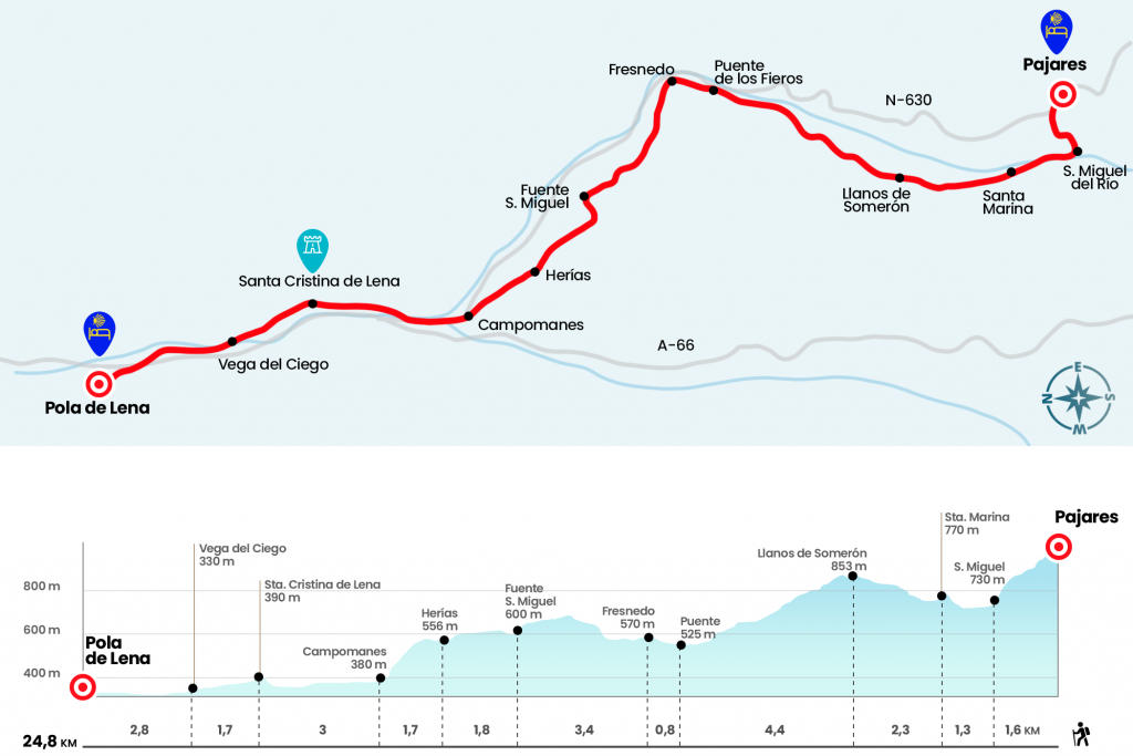
Stage from Pajares to Pola de Lena
km 24,8
Time 06H 30’
Difficulty High
Hostels 3
Available without an Internet connection
Ferrous stage; long and steep declines to Campomanes
Information about the stage 4: Stage from Pajares to Pola de Lena
Enlarge map
The hostels

¿Do you want to send any photo of "The Camino de Santiago"?
If you have any photos of "El Camino de Santiago" that you want to share with us, you can send them to us and enlarge the photo gallery
Forum: What pilgrims think about the Camino de Santiago
See all