Article translated by an automatic translation system. Press here for further information.
Poladura de la Tercia a Pajares Stage
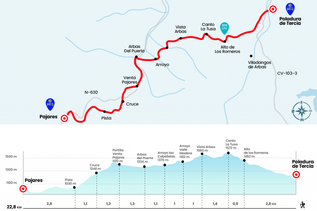
The stage records a slope of 344 meters to the Canto La Tusa
Information about the stage 3: Poladura de la Tercia a Pajares Stage
Enlarge map
The route
-
- Km 0. Poladura de la Tercia (Hostel. Country House)
We descend to the lower part of the town, passing by the Inn. When we reach the road we follow it to the left, crossing the river Rodiezmo, which flows from the Bernesga. We soon left the road through the right arch, following the indications of the Cuatro Valles grid. From this point, being a mountain section of less defined paths, we must guide ourselves in the distance, making sure we control the next arrow, tab or “lemon piruleta”.
The first grasslands lead to more rocky areas, with narrower steps. Leaving Peña Cháncara to the left, the Camino surrounds the collado Los Eros to climb to the top of Los Romero, where the cross of San Salvador rises (Km 2,8). The cross with her mast weighs no less than 250 kilos, and was placed by José Antonio Cuñarro “Ender” and 8 friends on September 22, 2012. We still have to save a level of 120 meters until reaching the Canto la Tusa, the highest level of the Camino de San Salvador (Km 3,7).
In front, at the bottom of the valley is Busdongo, the birthplace of Amancio Ortega and famous for its exquisite bread. However, we will not go to the town, but we will descend this hillside diagonally to the left, plunging into a clear forest trail (Km 4.3), about 100 meters the road rotates left again and ascending up to a hill to go forward now down. From this point we already see Arbas with his schoolgirl from Santa Maria (Km 5.1).
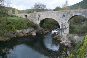
Between breezes and headlines we drop to the Madera valley, crossing the stream of the same name (Km 6.1). Then we go down a new hill to get down to another vallejo through the Las Stands stream, which winds along the majada homonymous (Km 7.1). About 200 meters after the majada we left on the right the most rotated path and followed a piece that opens a way between heather buds and panties. Drive to the same Arbas del Puerto, which we reached from a favorable position, crossing just before the zagal River Bernesga after passing a portilla.Caution when going to the N-630!
- Km 8.2. Arbas del Puerto
This village grew under the shelter of the Romanesque collegiate.In 1116, Count Fruela ordered the building of a guest house for the pilgrims. As in other Jacobean path hospitals, such as Ibañeta, O Cebreiro and Montouto, walkers found here amid these rough places, assistance and refuge. The journey continues towards the nearby high of Pajares through the N-630, which we avoid in the last section circulating through a parking lot.
- Km 9.5. Sale of Pajares (Bar-Restaurant)
See!, because our path deviates to the right before cornering the port, right by the back of the Casimiro sale.Do not go down the road!A warning that does not take away to reach the high and contemplate from the viewpoint the incredible panorama of the Macizo de Ubiña, with almost 60 summits that exceed 2,000 meters of height.
A well-deserved rest prepares us for the last part of the stage. At the back of the sale we transferred a portilla and climbed a short bit to the site of the Violina, where the first Asturian cairn of the Camino de San Salvador is located. We pass the wire fence and, already on the astur ground, we descend to the N-630 by a steep slope under the “wrinkle” of the high voltage line (Km 10,5). We cross the national and take the path that is born from the front, reaching 300 meters to the point where the itinerary is forked: from the front to the town of Pajares, where the hostel is located, and to the left to San Miguel del Río (without passing through Pajares) (Km 10,8).
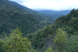
We resumed the front march towards Pajares. After the trail of the crutches, over a tupid bed of brews and retames, we later entered a spectacular beech and acebe forest (Km 11,2). After the hayedo we went to a clearing and continued to descend into a dirt track, which we followed to the right (Km 11,9). We drove through it for 1.2 kilometers and left it on the left, descending to another track that leads directly to the village. We entered Pajares through the La Campa district, next to the cemetery. The pilgrim hostel, where we will meet the endearing Marisa, is on Calle de Abajo, 100 meters after the church.
- Km 14.7. Pajares (Hostel. Bar)
The difficulties
Remarks
In images
The hostels

¿Do you want to send any photo of "The Camino de Santiago"?
If you have any photos of "El Camino de Santiago" that you want to share with us, you can send them to us and enlarge the photo gallery
Forum: What pilgrims think about the Camino de Santiago
See all