Article translated by an automatic translation system. Press here for further information.
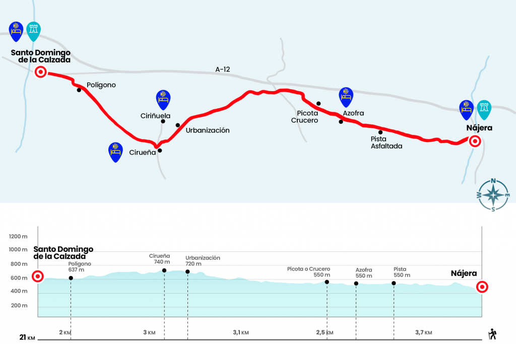
Step from Nájera to Sto. Domingo de la Calzada
A comfortable, simple and nice journey; villages with basic services
Information about the stage 9: Step from Nájera to Sto. Domingo de la Calzada
Enlarge map
Points of interest in the stage 9: Step from Nájera to Sto. Domingo de la Calzada
The route
- Km 0. (All Services)
The situation of the municipal hostel, at the western end of the city, and the urban walk of the previous day allow you to leave Nájera quickly. The street of the Mercado ends next to the monastery of Santa María la Real, an artistic insignia of the old capital of the Kingdom of Navarra. Founded in 1052, it was rebuilt in the 15th century in Gothic style. From the set stands the plateresque cloister of the Knights. On the side of the monument we took Costanilla Street and left Nájera on a clay track. Soon we left aside an agricultural vessel and crossed over the stream of Pozuelos or Valdecañas (km 1.8).
Above brea and, again, land, we definitely reached a paved runway (Km 3,8) that leads directly to Azofra, a farm villa located in the fertile Tuerto river plain. The best proof of his Jacobean past is the foundation, already in 1168, of a hospital and a cemetery for pilgrims.
- Km 5.7. Azofra (Hostel. Store. Bars. Pharmacy)
The Camino crosses Azofra through Calle Mayor, where the services are located. It should be noted that until Cirueña, the next village with some service,
there are 9.3 kilometers left. We say goodbye to the town next to the Real Casona de las Amas, a former illustrious family residence that has been rehabilitated for tourism. At the exit we took a short section of the LR-206 and, when we arrived next to the Romers' fountain, we turned left hand to resume the journey on tracks. After more than a kilometer we came across a picotta from the mid-sixteenth, symbol of justice (Km 7.2).
In the next few kilometers the route of the stage approaches during some section to the N-120 and crosses the Alesanco Road (Km 8.9). As for the landscape, the cereal fields are progressively scratching the ground to the vine, a sign that Castilla is close, although until tomorrow we will not give the definitive goodbye to La Rioja. After a one-kilometer repeat we arrived next to a merchant (Km 13), good place to account for lunch. Just ten minutes away we find a golf club and a residential complex that have built on the outskirts of Cirueña, a population to which we arrived later.
- Km 15. Cirueña (Hostels. Bar)
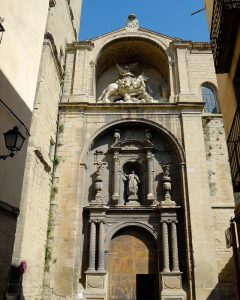
El Camino passes Cirueña de refilón through Barrio Bajero street. At the exit we find a short section of road that leads to another agricultural track. After a gentle undulation, Santo Domingo de la Calzada is discovered, where as a beacon the baroque tower of the cathedral unfolds. The prologue to Santo Domingo are several warehouses and warehouses (Km 19.5). Then we continue along the access road that leads to the streets May 12 and Major, where is the ambitious pilgrim hostel.
- Km 21. Santo Domingo de la Calzada (All Services)
The difficulties
Remarks
In images
What to see, what to do
The hostels

¿Do you want to send any photo of "The Camino de Santiago"?
If you have any photos of "El Camino de Santiago" that you want to share with us, you can send them to us and enlarge the photo gallery
Forum: What pilgrims think about the Camino de Santiago
See all