Article translated by an automatic translation system. Press here for further information.
Seville to Guillena stage
It is advisable to reach Seville one day before starting the stage
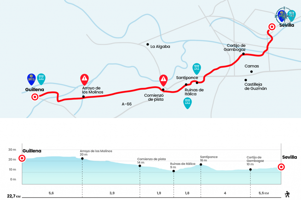
Information about the stage 1: Seville to Guillena stage
Enlarge map
Points of interest in the stage 1: Seville to Guillena stage
The route
- Km 0. Sevilla(All services)
The adventure of the Vía de la Plata, in addition to the Roman road, the pilgrimage to Santiago par antonomasia of the western peninsular begins at the gates of the Cathedral of Seville. Specifically next to the door of the Asunción, located on the Avenida de la Constitución of the Andalusian city. The first vieira guides us through Calle García de Vinuesa and we continue through the streets of Jimios, Zaragoza, Reyes Católica. In the latter we cross the Puente de Isabel II to access the popular neighborhood of Triana. We walk through the streets of San Jorge, Callao and Castilla, where the Chapel of the Puppy is located. A few meters later there is a kiosk and, on your right, a ramp and stairs through which you access the highway.
We cross and, after a roundabout, we go down to a parking lot and cross a pedestrian bridge over the Guadalquivir. There is a well-indicated alternative to go to the population of Camas or continue along a path parallel to the Guadalquivir with the indication of ‘Rio’. We choose the latter, which advances along the river “Rio Grande”, translated from Arabic. It doesn't give you time to savor it, because in just over a kilometer and a half, at the height of some ancient houses, from the 19th century and known as Cortijo de Gambogaz, the arrows leave the river and go through a left hand path. Notice this! (km 5.5)
We advance along this road, with reference to Beds and the Cerro de Santa Brígida, located on our left. You have to go under the A-66, known as the Silver Highway, a couple of times and, in between, under the railway bridge. In the distance we can already observe the structure of the Monastery of San Isidoro del Campo, Cistercian of the 14th century, located at the entrance of Santiponce.
- Km 9.5. Santiponce(All services)
We can stop to see the monastery or continue for more than a mile through the village until the entrance to the Archaeological Complex of Itálica. The ruins and amphitheater of this Roman city, founded in 206 BC and cradle of the emperor Trajan, well deserve a visit. Itálica will represent for the pilgrims the first Roman milestone of the Vía de la Plata and we will continue to Mérida following the route of the road that linked this town with the mouth of the Guadiana (Km 11,3).
The stage continues through the A-8079, secondary road without arcén, where we travel a little more than a kilometer. We got to a roundabout, we crossed the N-630 and we went to La Algaba, passing by the highway. Only a few hundred meters because the arrows are diverted to the left and continue on a large service track of Emasesa (km 13.2).
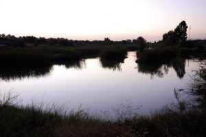
It is an endless line between cotton fields, more straight than a bourbon, which after four kilometers is touched with the flow of the Arroyo de los Molinos. This is the first obstacle to this pilgrimage, and it has caused many problems for pilgrims. If it brings little water, the solution passes through it carefully. A pilgrim informs us that 5 or 10 meters before reaching the stream there is a small and narrow detour to the right that passes by the tower to cross it through a metal bar that makes a bridge. If that were also impossible to cross, we would have to take a runway to the left before the stream that takes us to the road and continue down the road to Guillena with caution.(km 17.1)
After passing the stream, with Guillena already on the horizon, we continue in a straight line along the runway. After three and a half kilometers we turn right when we reach a huge field of cultivation and two kilometers later we save the stream Galapagar flow to present us in Guillena. The Portugalete and Real streets lead to the City Hall.
- Km 22.7. Guillena(All services)
The difficulties
Remarks
In images
What to see, what to do
The hostels

¿Do you want to send any photo of "The Camino de Santiago"?
If you have any photos of "El Camino de Santiago" that you want to share with us, you can send them to us and enlarge the photo gallery
Forum: What pilgrims think about the Camino de Santiago
See all