Article translated by an automatic translation system. Press here for further information.
Xunqueira Stage from Ambía to Ourense
Scattered journey of many parishes between asphalt and industry
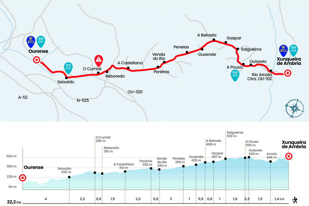
Information about the stage 9: Xunqueira Stage from Ambía to Ourense
Enlarge map
Points of interest in the stage 9: Xunqueira Stage from Ambía to Ourense
The route
- Km 0. Xunqueira de Ambía(Hostel. Bars. Shops. Pharmacy)
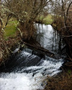
We move to the centre of the village by the road of entry and, before reaching the monastery, a Jacobean cairn urges us to leave the road and go down to a fountain. There is a plaque dedicated to Don Elect Rivas Quintas, priest and writer and co-founder of the Association of Friends of the Camino de Santiago. After this monument, the best option is to return to the road and reach the nearby monastery of Santa Maria la Real, ancient cenobium whose church goes back to the 13th century and possesses an interesting Gothic cloister of the 16th century. After its contemplation we threw in front of Captain Cortés street and turn right to reach by the Health Center, which we left on the left. Then we go down a road to the same road, where we cross the Arnoia River, the longest of the province of Ourense as from its birth, in the Sierra de San Mamede, it travels more than 84 kilometers to reach the Miño (Km 1,4).
In 150 meters we leave the road on the right and take a road that leads us to cross the road that comes from San Xillao. We are still right on the runway and on the way to the 0U-102, through which the stage of today will be almost complete. We arrived at Outorelo (Km 3,3), and shortly to A Pousa, where we went next to a chapel dedicated to the Virgen del Camino.
- Km 3.6. A Pousa(Cafe-Bar)
The next is Salgueiros (Km 5.2), where it marks 17 kilometers to Ourense by road. One kilometer later we arrived to Gaspar (Km 6.2) of the Concello de Paderne, where we left for a moment the road. A few hundred meters later we met A Veirada (Km 6,8) and crossed a bridge over the train tracks. Then we passed a bridge over the railway to arrive in Ousende (Km 7,7) and then in Penelas, with bar.
- Km 8.7. Penelas (Bars)
Before such a rosary of populations it is difficult to distinguish where one ends and the next begins. Almost without leaving the scattered nucleus of Penelas comes A Neta, located at the junction that diverts to Coucieiro. We passed over the river Cerdeiriño and Barbaña and entered Venda do Río, del Concello de Taboadela (Km 10,7). Then we come to Pereiras, where there is another bar.
- Km 11.3. Pereiras(Bar)
At kilometric point 12 of the OU-102 we pass under the railway bridge, just where the Concello de San Cibrao das Viñas begins (Km 12,4). After A Castellana (Km 13.5), where some shops and bars are located, we arrive at a roundabout, entrance door to the polygon of San Cibrao. We followed her forward and turned to the left to reach another roundabout. Be careful! because here you have to turn slightly to the right, where OU-0514 is born. We fired from the polygon to reach Reboredo.
- Km 15.4. Reboredo(Bars. Shops. Pharmacy)
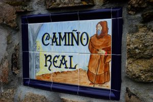
At the end we follow the indications of the sculpture of Nicanor Carballo marked as Old Camiño de Santiago. No truck because we continue to asphalt up to the Alto do Cumial (Km 16,5). On the high
we cross the road to go out a road stuck to the arcén. We go down by the fence of a company and we get to the road. We left it on the right and threw it down the Santa Adega rua to the train tracks. There is a fence, the tracks are saved by a lower step and then turned right. We cross the road and enter Seixalbo through Amendo rua.
- Km 18.2. Seixalbo(Bars. Shops)
This town was declared a Set of Ethnographic Value and formerly depended on the jurisdiction of the Bishop. He had his own prison and roll, exactly where today is a plateresque cruise of the 18th century, next to which we went to take the Mayor and then the Eirexa Rua, located on the left hand. We went by the geometric facade of the church of San Breixo and reached the first houses of Ourense through Verea Real Street.
We arrive at Avenida de Zamora and, we pass a roundabout and continue along the same avenue that later becomes Rúa Progreso, then turn right onto Calle Doctor Marañón that takes us to Plaza Mayor. near this in the Rúa Barreiros is the hostel of pilgrims of the Xunta.
- Km 22.2. Ourense(All services)
The difficulties
Remarks
In images
What to see, what to do
The hostels

¿Do you want to send any photo of "The Camino de Santiago"?
If you have any photos of "El Camino de Santiago" that you want to share with us, you can send them to us and enlarge the photo gallery
Forum: What pilgrims think about the Camino de Santiago
See all