Article translated by an automatic translation system. Press here for further information.
Pamplona/Iruña to Puente la Reina/Gares stage
Finally only 24 kilometers from Puente la Reina
Information about the stage 4: Pamplona/Iruña to Puente la Reina/Gares stage
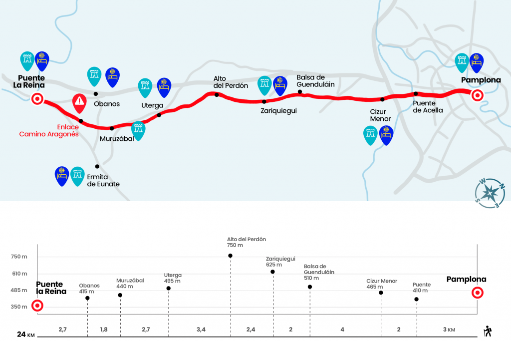
Enlarge map
Points of interest in the stage 4: Pamplona/Iruña to Puente la Reina/Gares stage
The route
- Km 0. Pamplona (All Services)
Two dozen kilometers separate Pamplona from Puente la Reina. Descending the street of Curia to Mercaderes, the famous curve of the Encierros of San Fermín, we reached the Plaza Consistorial. The facade of the City Hall, a baroque and neoclassical mix, was built in 1752. We continue through San Saturnino and head to toe Calle Mayor. After a pedestrian step we advance to the Army Avenue and enter the Vuelta del Castillo, a beautiful park grown around the defensive stronghold of the Ciudadela.
Later on, signaling forces to leave the green area to access Fuente del Hierro Street, which crosses Sancho el Fuerte Avenue and leaves to the University of Navarra. The private institution is abandoned by the Acella bridge over the Sadar river (Km 3). By an andadero, after two kilometers, a slight slope is reached to Cizur Menor, population of the Cendea de Cizur. Cendea is a term used in Navarre to designate the group of several towns that make up a single municipality.
- Km 5. Cizur Menor (Hostels. Bars. Store)
At the entrance, on the left hand, is the church of San Miguel and on the right, further away, the parish of San Emeterio and San Celedonio. We leave Cizur between townhouses and uni-relatives, the result of the urban collapse of the cities and the desire to flee to quieter places. Drastically, cereal fields and concentration slopes take over the landscape and we start to gain height with peace. We will reach a small raft of water in the place of Guenduláin, old depopulated manor - to the right of the Camino - formed by the palace and the church (Km 9). A couple of kilometers above is Zariquiegui, the last population of the Cendea de Cizur on the Camino de Santiago.
- Km 11. Zariquiegui (Hostels. Store)
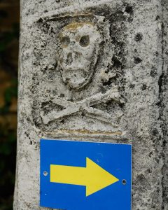
At the entrance we receive the geometric and grandiose bearing of San Andrés, a temple that still retains a sober Romanesque cover. Among some glimpses of blasphemous houses, we can accommodate the last part of the climb. We leave the tracks and take a more interesting path that opens the way between boj and thorns. We will reach the source of Gambellacos, commonly known as the name of Reniega. The legend tells that in this place, the devil
offered water to a thirsty pilgrim in exchange for reneging from God, the Virgin and Santiago. The pilgrim, half-dying, despised the drink and prayed until the devil left and the source that brought it to him appeared. Saciados too, we dedicate the last effort to the high of the Sierra del Cil, a natural barrier between the Pamplona Basin and Valdizarbe.
- Km 13.4. Stop of Forgiveness (Walking Bar from 8:00 to 16:00. From 1 April to 31 October)
It is a good place to drop the backpack, eat something and take some pictures along with the original work made in veneer by the artist Vicente Galley, who shows a caravan of pilgrims from different eras representing the evolution of the Camino throughout its history. Under the hum of the wind turbines, after a well-deserved rest, the descent begins over uncomfortable loose stones and between coscots and holm oaks. Uterga, first of Valdizarbe, is the next village of our rutometer.
- Km 16.8. Uterga (Hostel. Hostel. Bar)
Two kilometers and seven hundred meters later we arrived at Muruzábal.
- Km 19.5. Muruzábal (Hostels)
We cross Esteban Pérez de Tafalla Street, where is the parish of San Esteban. In Muruzábal you can also admire the baroque palace of the same name, today converted into a winery. From Muruzábal it is possible to deviate to the Eunate hermitage (see observations). We resumed the march towards Obanos, which was conquered after a repeat.
- Km 21.3. Obanos (Hostel. Bars. Store. Office. Pharmacy. ATM)
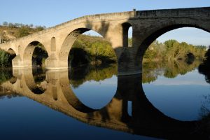
The Town Hall Square, next to the church of San Juan Bautista, serves as a union between the pilgrims from Somport and those from Roncesvalles. We passed under the pointed arch of the Obanos door and went down to the road, which we crossed to continue to the Robo river valley to the entrance of Puente la Reina. Next to the church of Santiago the two dozen kilometers are fulfilled.
- Km 24. Puente la Reina (All Services)
The difficulties
Remarks
In images
What to see, what to do
The hostels

¿Do you want to send any photo of "The Camino de Santiago"?
If you have any photos of "El Camino de Santiago" that you want to share with us, you can send them to us and enlarge the photo gallery
Forum: What pilgrims think about the Camino de Santiago
See all