Article translated by an automatic translation system. Press here for further information.
FORGOTTEN PATH
By Jacinto Prada Baro | 15/02/2021
We are in the 9th century. King Alfonso II reigns. The alleged tomb of the Apostle James is discovered. King Casto visits Compostela. The influx of pilgrims grows rapidly because there was previously a long history of European pilgrimages that especially by boat reached the northern peninsular to visit Liébana and the Santa Chamber of Oviedo: the relics at that time were powerful magnets of religious attraction. Thus, the “Primitive Path” only extends the axis of pilgrimage: Liébana-Madrid-Composteala.
The new policy of the Astur king changes the structure of Christian geography. It ceases to be in a resistance plan hanging behind the natural wall of the Cordillera. He makes raids on the other side trying to create an empty “no man’s land” that would keep Muslim harassment at a certain distance. Defensive and vigilant fortifications are gradually being built in the southern skirt. Abbot Vitagus and bishop Juan begin to repopulate the Mena Valley. The population pressure of the Astur kingdom and the living conditions of the Mozarabs of Al-Andalus see in this depopulated space of the southern side of the Cantabrian Rim an opportunity. New monasteries are founded: Mena Valley, Paterniani Area, Palentine Mountain, Boñar Area, Bertian Tebaida…
The transfer of the Capital of the Kingdom to León at the beginning of the 10th century represents a new impulse in the consolidation of the Christian population in this territory: a line of castles is built that marks a new border: Espinosa de los Monteros, Aguilar de Campoo, Cervera de Pisuerga (El Castillo, Peña Barrio, Peñas Negras and Vallejera), Castrejón (Pinilla), Entrepeñas (Peñacastillo), Guardo, Aquilare (Sabero), the “Castillones” (Boñar) Balmaseda, Nava de Ordunte, Casasola, Mat of Santa Gadea, Aguilar (Major and Portazgo), Salinas de Pisuerga, Cervera, Puente Almuhey, Cistierna (the Market), Boñar (Old Bridge), Vegapujín, Conincentivoso, Cacaboso
Thus, from Bilbao, an alternative that, following the mountainous skirt that closes the plateau, reaches the Bierzo to join the Primitive Path in Melide. This new route also shares paths with real guns and transhumant cords. Until the 12th century this Camino was surely the main Jacobean route for its security against the Saracens, guarantees of passage through their bridges and sufficient infrastructures of welcome. However, this Camino maintains a great porosity establishing links with the two great poles of reservation: Lebaniegos roads and the Camino de San Salvador.
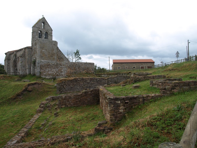
The monasteries that were set up on the south side of the mountain range undoubtedly had great importance in Jacobean logistics: the great Cenobians raised by the abbot Vitagus and Bishop Juan, Sisenando, Abitus, Gonzalo were then added the family and private monastery welcomed to the presuras system. They were the basis of the repopulation and the reference nodes of a network of roads that the pilgrims took advantage of. But the convent importance of the Jacobean infrastructure must be delimited because the pilgrims who stayed there were a minority: clergy, nobles, wealthy people who left good handouts. The vast majority stayed in the porticos of the churches or in pajares, corrales, sheds.
One of the most important tests of the existence of this route is a full itinerary of Romanesque constructions typical of this historical period: we found a good number of small rural churches, but also masterpieces of the first line: San Lorenzo de Vallejo, Santa María de Siones, Collegiate of San Pedro (Cervatos), Monastery of Santa Maria and the church of Santa Cecilia in Aguilar de Campoo or Santiago de Villafranca del Bierzo (Puerta del Lamento). Legends also capture the pilgrim and Jacobean legacy, especially in the Leonese section.
The consolidation of the border with the Muslims on the bank of the Douro meant the repopulation of the northern Plateau which until the end of the 11th century was “no man’s land” and therefore insecure for pilgrim and commercial transit. This is how the great mesetarian burgos with its areas of influence and interconnections are configured and consolidated. So there comes a time when the Papacy and the Christian kings decide to make the Camino de Santiago even more profitable by opening a new route through flat lands: this channelling of the pilgrim stream would allow the fixing of population and the economic and commercial increase for the benefit of political and religious power. They commend this work to Emeric Picaud who designs the outline that will be included in book V of the Code Calixtino ( 12th century). At this point is the beginning of the decline of the Old Way. However, this was a long process: the internal wars and territorial frictions of the Christian Kingdoms took a long time to settle a stable peace for a good few years. On the other hand, the order of St. John of Jerusalem was also implemented in these territories, there is evidence of exemptions from the payment of portazgo in some bridges (Boñar) until the 14th century and on this route important Gothic, Renaissance and even Baroque monuments continue to be built that bear witness to the maintenance of the relevance of the most important villas of the route. With all this, time gave its ruling: the Old Road became a FORGOTTEN ROAD.
This ancient route not only offers us an extraordinary historical, artistic and cultural legacy, but also gives us the opportunity to enjoy exceptional panoramic views and cross enchanting places: the Cadagua River, the Mena Valley, the Burgese Merinity, the Valdolea Region, Palentine Mountain, Leonesa East Mountain, Omaña, the Bierzo. Crystal clear rivers, torrenteras, waterfalls, green mountains and sometimes agrestes, pastoral valleys… Surely you will not forget Peñacorada or the Campa de Santiago. Also the Forgotten Road will allow us to enjoy a varied cuisine and traditional bakery of high quality and forceful..
The Forgotten Road also has a Malaga arm that meets the bilbaíno path in Aguilar de Campoo. It is difficult to prove the historicity of this route. The Kingdom of Pamplona (or Navarre) was in a great instability due to its border nature: in this scenario were competing French, Leonese, Castilian, Aragonese and Muslims. So they were very conflicting lands that threatened the safety of pilgrims. Sancho Garcés III (1004-1035) is usually attributed to the final control of the territory “from the same Pyrenees mountains to the castle of Nájera, taking out of the power of the pagans how much land is contained within, made the Camino de Santiago run without backward that the pilgrims twisted through Álava with fear of the barbarians” (Manuel Gómez Moreno). However, the Battle of Atapuerca (1054) continued to show the danger of this area. In the link at the end of the text you will find information about this itinerary.
If we encourage ourselves to take the lead in the recovery of the Forgotten Road, we will tune in with the little pieces of history, we will inherit the heritage of so many centuries of human life, we will value the meaning of so many testimonies our ancestors have left us, we will stimulate our artistic sensitivity, we will keep in retinas and chambers the singular beauty of so many landscapes. We will find simple people with good feelings. And at the bottom of our heart and our backpack we will archive unique experiences that can lead us to conclude as a pilgrim said to me: “This is a way too beautiful to be a Forgotten Road.” Warning for walkers: avizor and soul to flower of skin. Good Way.